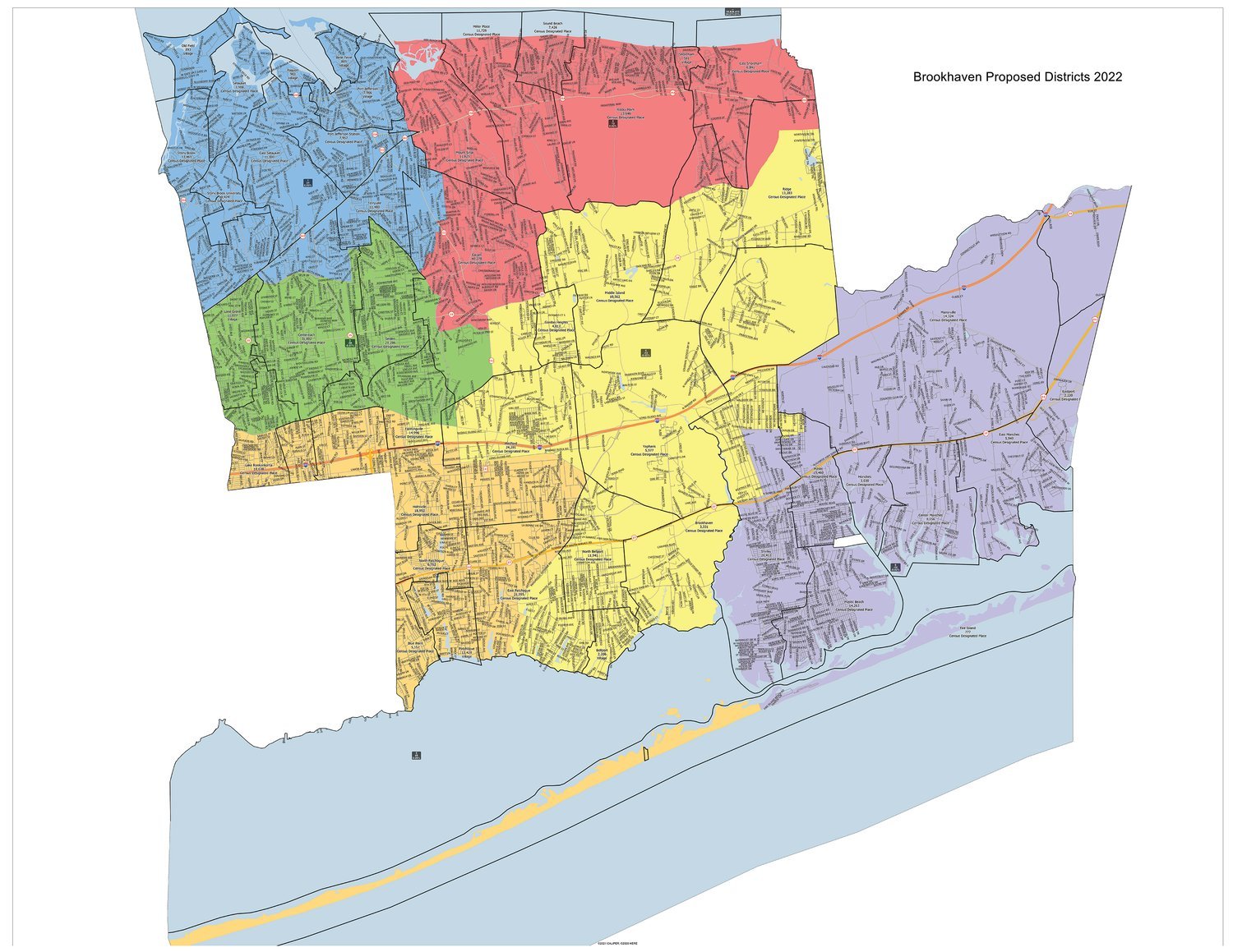
The Town of Brookhaven held a public hearing to discuss the commission’s proposed map on Thursday, Sept. 29, to amend Chapter 27 entitled “Procedures for Ballot Propositions Proposing Ward (Council) Districts and Reapportionment.” Directly following the hearing, the town board approved the new map, which will set council district lines for the next 10 years.
According to the town, the new map maintains the vast majority of residents without change, meaning 90.55 percent will remain in the same council district from the last cycle. The map also improves compactness, with 100 percent of North Bellport now existing within District 4; currently, a portion is in District 5. The change, according to the town, was done in response to the community’s request over the past several years to be represented by a single council member, as well as the increase in the minority population in every district when compared to the 2010 population. Additionally, the new map has 10 split hamlets in comparison to the current 13 split communities. The communities to remain split will remain so, due to community requests to maintain likeminded neighborhoods rather than zip codes. These communities include Coram, which will remain split in order to maintain Gordon Heights as a community, while zip code 11720 will remain with Centereach, including South Setauket Park. Also, the new map reduces the number of school districts that are split from nine to four.
Main Street gets beautified
The Town of Brookhaven recently approved the Beautification of Main Street in Eastport as a program for public good. The town signed on as a co-sponsor qualifying the program for insurance coverage. The coverage will protect all seasonal decorations and lights to be placed on lampposts for the holiday season.


Comments
No comments on this item Please log in to comment by clicking here